
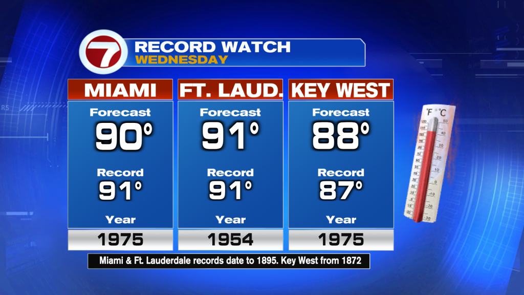
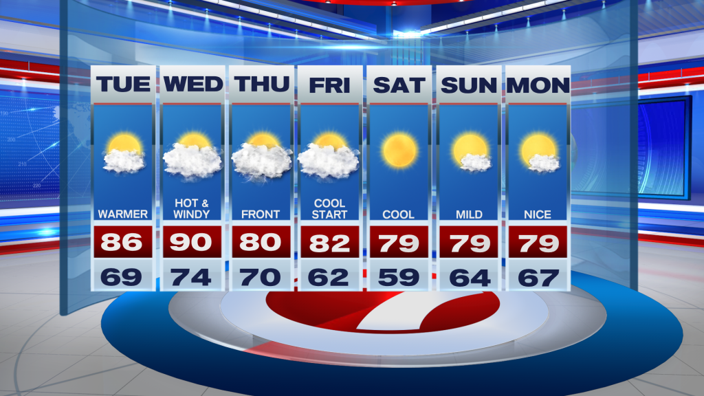
Today promises to be warmer with winds out of the South, so highs will climb into the mid and upper 80’s. However, by tomorrow, near-record heat possible. This is due to another cold front approaching from the North. Forecast highs expected to near 90 degrees and feeling much hotter when you combine the higher humidity.
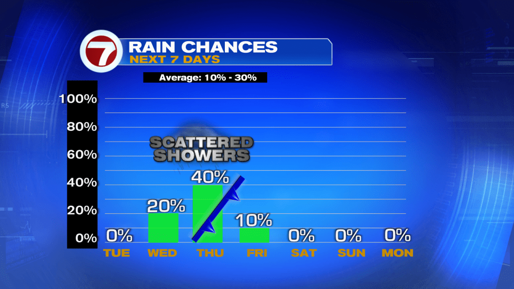
Models are showing some showers starting Wednesday night, but most of the activity happening on Thursday. It will be mainly scattered showers until the front completely clears South Florida.
You’ll notice a nice change on Friday as conditions begin to cool down. If model guidance is correct, several areas could be waking up into the upper 50’s on Saturday.
Vivian Gonzalez
Meteorologist, AMS Certified
WSVN Channel 7