
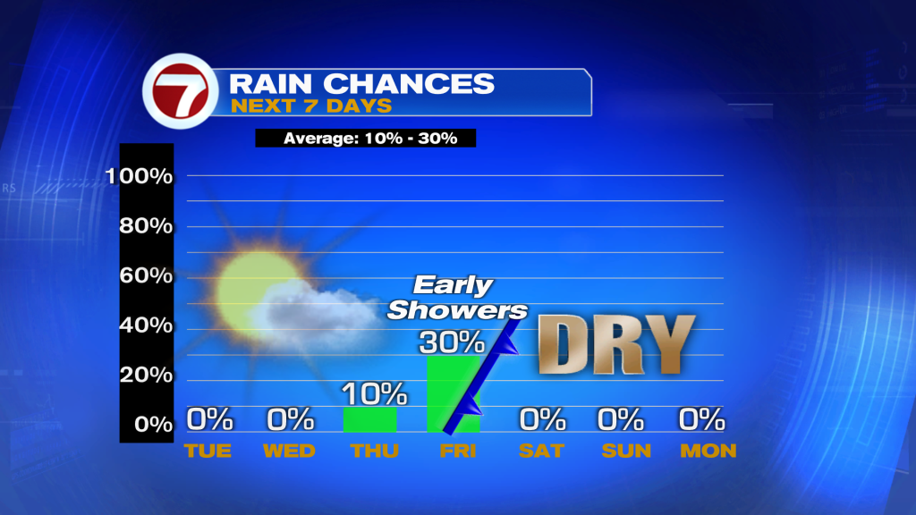
Pattern turning windy and warmer with a distant area of high pressure in the Atlantic Ocean. This will open up the avenue for a front to move into the Eastern U.S. on Thursday. We are expecting it to be the most steamy day this week.
A few showers possible late Thursday and mainly overnight/morning on Friday.
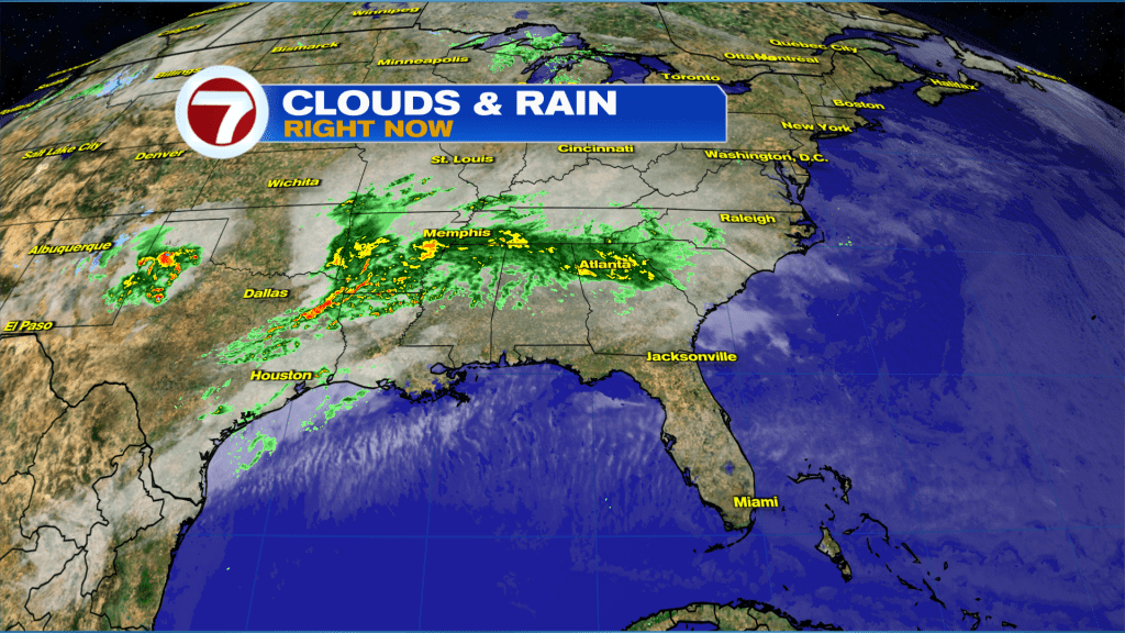
Severe storms are expected to produce several tornadoes, significant large hail, damaging winds, heavy rains and flash flooding across most of Texas into the Mississippi Valley.
Have a wonderful day South Florida and make it a safe one!
Vivian Gonzalez
Meteorologist, AMS Certified
WSVN Channel 7